Breathing New Life Into Littlehampton Seafront
10th July 2024
Geoenvironmental • Geotechnical
Our Client
Preliminary-Assessment
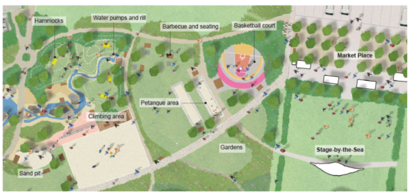
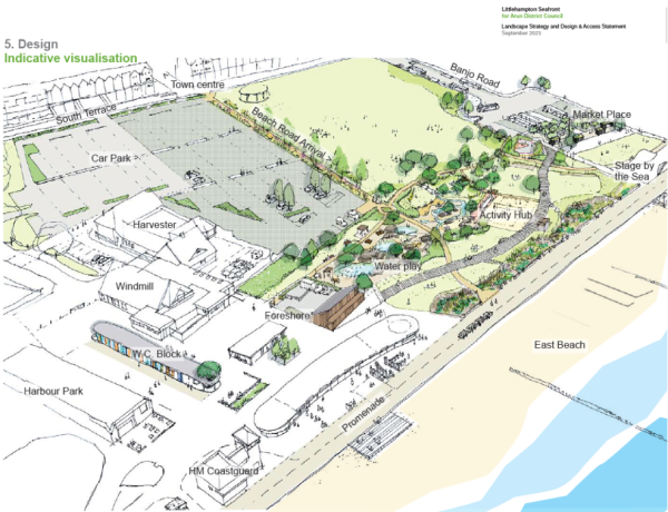 The proposed development was understood to comprise the construction of a new toilet block, new beach showers, resurfacing of the overflow car park, new pedestrian walkways and the creation of an activity hub including beach volleyball, boules, a climbing boulder, a half basketball court and a water feature with shallow rock pools, waterfalls and water jets. It was also proposed to install a large underground water tank with an anticipated founding depth of 4.00m bgl.
The site comprised an ~3,100m2 approximately square-shaped plot of land, located south of Sea Road and to the north of the promenade on the seafront in Littlehampton. The site comprised an open area of soft landscaping and grass surfaced overflow car parking area. The site was accessed off Sea Road to the north.
A review of the historical maps for the site showed that the site formed part of a larger undeveloped area from the earliest available map (1876 – 1878). An excavation was shown in the north-west corner and a path was shown crossing the centre of the site in an east to west direction. A Coastguard Station was located to the immediate west. By 1898, the excavation in the north-west corner was no longer shown and was assumed to have been infilled. A small structure was shown in the south-west corner. By 1912 Banjo Road was shown along the eastern boundary. The 1932 map showed a toilet block had also been constructed in the south-west corner. On the 1957 – 1958 map and amusement arcade had been constructed to the west and the western portion of the site comprised a car park. A putting green was shown in the south-east corner. There were no significant changes to the site shown on the subsequent maps.
The geological maps for the area revealed that the site was underlain by the superficial Raised Beach Deposits and the Blown Sand classified as a Secondary A Aquifer overlying the Undifferentiated Lewes Nodular Chalk Formation, Seaford Chalk Formation, Newhaven Chalk Formation, Culver Chalk Formation and Portsdown Chalk Formation classified as a Principal Aquifer. A chalk dissolution risk assessment indicated a very low risk from the dissolution of soluble rocks at the site.
Our Challenge
A Ground Investigation was required to provide the following information:
- Ground conditions for foundation design via the drilling of a borehole to 5m bgl with associated in-situ and laboratory geotechnical testing
- Groundwater conditions for deep excavations by undertaking a period of groundwater monitoring within a standpipe installed in the borehole between October 2023 and March 2024
- Hardstanding design by in-situ CBR testing using a DCP
- Off-site waste disposal of surplus soils by undertaking chemical laboratory analyses.
The Ground & Water Approach
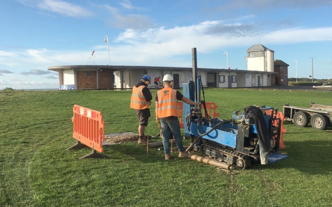
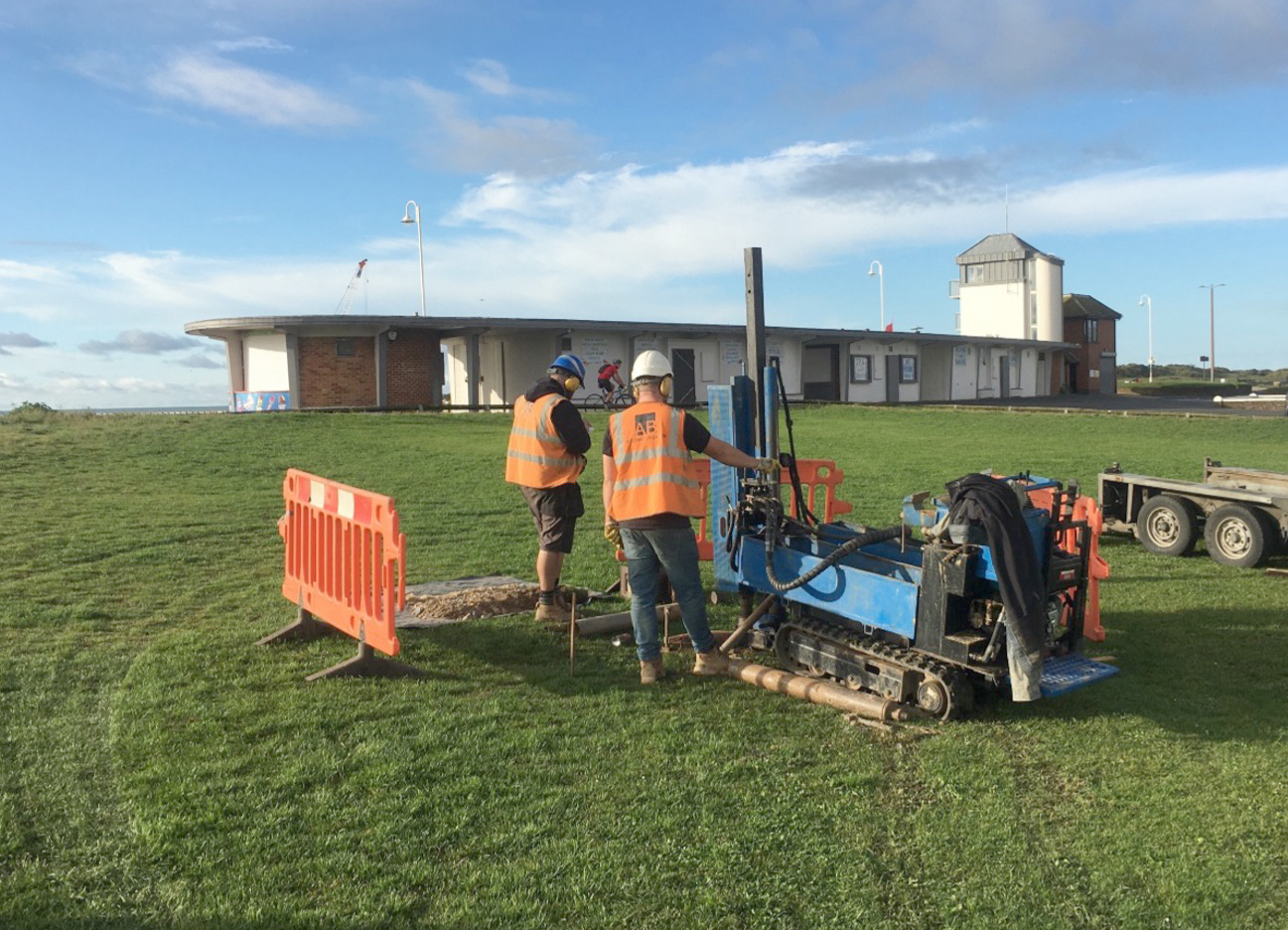
 Phase I was undertaken on 20th October 2023 and comprised the drilling of one Windowless Sampler Borehole (BH3) to a depth of 5.00m bgl. Standard Penetration Tests were carried out at 1.00m intervals within the borehole. Additionally, eight in-situ DCP tests were also undertaken at locations across the site. A combined groundwater and ground-gas monitoring standpipe was installed to 5.00m bgl, with a response zone installed between 1.00 – 5.00m bgl. Ten return groundwater monitoring visits were undertaken between October 2023 and March 2024.
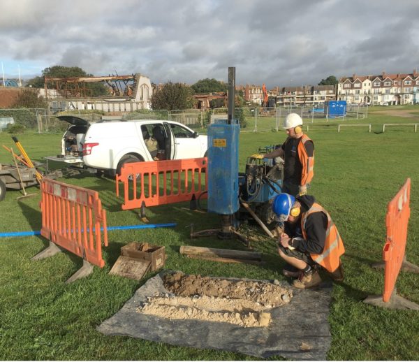
Phase II was undertaken on 22nd April 2024 and comprised the hand excavation of seven Trial Pits to a depth of 1.00m bgl to obtain soil samples for contamination analyses and WAC testing. Additionally, a further four in-situ DCP tests were also undertaken at locations across the site.
The ground conditions in the trial holes revealed a 0.25 – 0.50m capping of Topsoil and 0.85 – >1.00m capping of Made Ground were found in two of the trial pits, overlying granular Raised Beach Deposits and Blown Sand for the full depth of the trial holes at a maximum depth of 5.00m bgl in BH3. No chalk was encountered. Based on nearby BGS boreholes, chalk was likely to be encountered ~7.00m bgl. In-situ testing in BH3 classified the Raised Beach Deposits as medium dense and the Blown Sand as loose to medium dense with the loose spot encountered at 3.00m bgl.
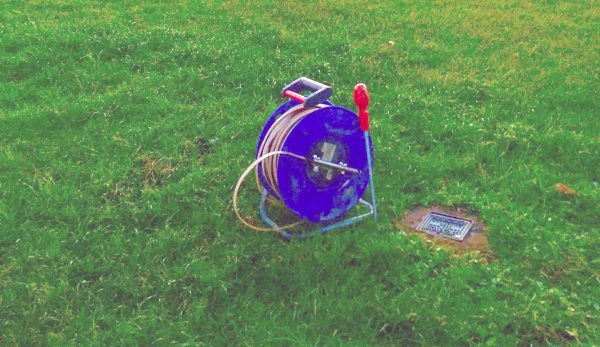 Groundwater was only encountered in BH3 at a depth of 4.00m bgl, rising to 3.88m bgl upon completion of the borehole and removal of the casing. Monitoring of the standpipe revealed groundwater levels fluctuated between 2.90 – 3.60m bgl with no apparent variation with tidal fluctuations.
Geotechnical laboratory testing revealed the soils of the Raised Beach Deposits and the Blown Sand Deposits had no volume change potential in accordance with both BRE365 and NHBC Standards Chapter 4.2.
Chemical laboratory testing was undertaken on one sample of Made Ground and six samples of Topsoil across the site revealed that the samples were NON HAZARDOUS and WAC testing revealed them to fall within the INERT WASTE CLASSIFICATION.
The results of the in-situ DCPs showed that CBR values within the Raised Beach Deposits generally ranged between 7 – 55%.
The Outcome
 The investigation revealed foundations for new structures should be taken through any Topsoil or Made Ground and found on competent soils of the Raised Beach Deposits at a minimum depth of ~0.75m bgl and can be designed based on a presumed allowable bearing capacity of 100 – 125kN/m2. This is based on trial hole records, the results of in-situ testing, inspection of samples recovered, and based on a 5m long by 1m wide foundation and a maximum settlement of 25mm. Settlements on loading are likely to be moderate.
Care will be required during the proposed excavation for the underground water tank to the proposed depth of 4.00m bgl since it was possible groundwater would be encountered so dewatering may need to be considered.
Should any future construction works take place in the area of the infilled ground workings in the north-west corner of the site below the existing car park, additional investigation would be required to determine the nature and depth of the soils used to infill the former excavation.
The project is an excellent example of how Ground & Water successfully works with both private and public sector clients.