Dark Satanic Desk Studies
Geoenvironmental • Regulation
What comes to mind during Phase 1 Desk Studies, when you see the word “Mill” on an Ordinance Survey map?
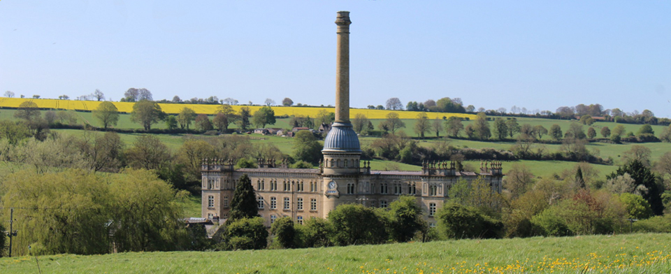
For some, it’s idyllic sunny hillsides of Camberwick Green, but for most of us, it’s the iconic red bricked buildings of Manchester’s Cottonopolis. The question is, how many of us know that British Cotton Mills and other industrial sites, had a dark side involving Cold War paranoia and Soviet sabotage?
By the start of the Cold War, it was already common practice by Ordnance Survey, to alter the maps where specific military installations were present. Prior to WW2 this was done to protect from Luftwaffe bombing raids. This practice of censorship was instigated as far back as 1927 by the Prime Minister Stanley Baldwin. He said: “No works or defence shall appear on any map on sale to the general public. No blank space shall appear, but the natural physical feature of the country shall continue to appear”. During the Cold War, the definition of a “Mill” was broadened for British cartographers, from the traditional lighter industries such as corn, paper and textiles, to include heavier industries such as gas works and chemical factories.
In 1957 it was decided by MI5 that to reduce the risk of Soviet sabotage, important industrial buildings should also be protected by censorship and their locations be miscommunicated on public maps. The terms “Mill” and “Works” were adopted for generic use and applied to mapped buildings regardless of industrial activities. The regulations began to become relaxed around 1964, when only a basic description could be displayed. It is suggested that it was not until 1991, once the political chest puffing had ceased and iron curtain had fallen, that the regulations were fully relaxed.
So what does this mean for contemporary analysis of proposed redevelopments? Well, for most of the 20th Century, Ordnance Survey maps do not provide the full picture of past industrial land-use activities. This therefore can cause a significant issues during Phase 1 Desk Studies. These desktop analysis, form a crucial part of the planning application process. Care must be taken when assessing the past industrial land-uses and any “Mill” or “Works” identified should be thoroughly researched.

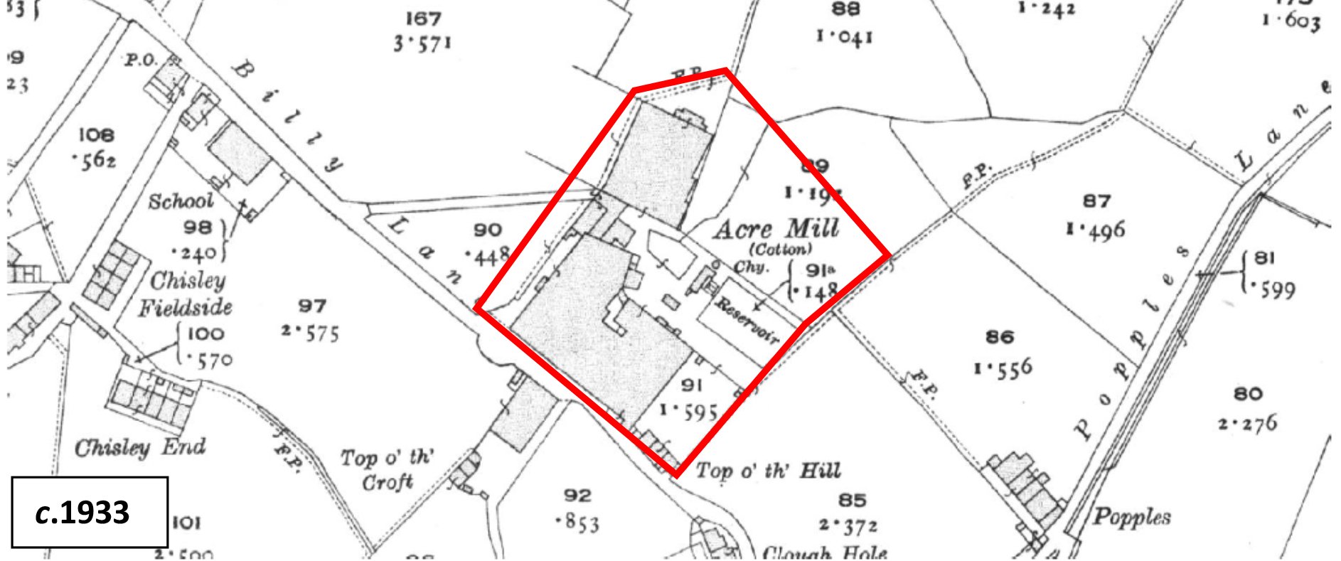
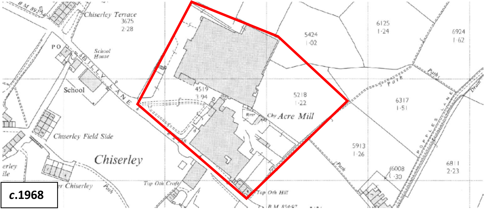
A sinister example of this is Acre Mill, Hebden Bridge. During the 19th Century, Acre Mill was used for cotton production. By 1939 it had been bought by Cape Installation Limited and was transformed into an asbestos processing plant for the construction of gas mask filters during WW2. The Mill was operational until 1970, but due to the censorship of the Ordnance Survey maps during that period, no reference was given for the site’s actual industrial land-use (see below). By 1979, it was reported approximately 12% of the mills workforce (~264 people) had died of asbestos related diseases and that during the Mill’s years of operation, Cape Installation Limited had repeatedly broken to law in regards to asbestos dust control. The Mill was also shown to have also impacted the lives of local residents living within proximity of the Mill.

The Acre Mill is an unfortunate example of how caution must be exercised when assessing the historical land-uses surrounding any site for proposed re-development.
When it comes to former industrial sites from the 19th and 20th Centuries, it is essential to thoroughly research and investigate to ascertain a complete history rather than just taking the features displayed on old maps at face value. At Ground and Water we cross-reference pre and post-war historical records, along with contemporary datasheets to perform proper contextual due diligence on each of our client’s sites.
This is carried out before any project is moved onto the Phase 2 Ground Investigation.
For more information on Phase 1 Desk Studies and Pre-Acquisition Studies click here to contact us.
